
Avon ZIP Code Directory Coverage
The verified postal ZIP for City of Avon civic addresses is 44011. City Hall materials, CityView, police, and city-directory materials use Avon, Ohio 44011. The nearby code 44012 is not a second city ZIP. It belongs to adjacent Avon Lake. Keeping that distinction visible matters when a search begins with a postal address, because the city custodian, postal label, and parcel geography may serve different purposes.
| ZIP | Area and civic geography | Post office | Research note |
|---|---|---|---|
| 44011 | City of Avon civic and government address geography | Avon Post Office, 36225 Detroit Road, Avon, OH 44011-9998, 440-934-7145 | Validate each exact address with the USPS lookup. |
| 44012 | Adjacent City of Avon Lake, north of Avon | Avon Lake Post Office, 33501 Lake Road, Avon Lake, OH 44012-9998 | Not a second City of Avon ZIP. |
No authoritative source in the research showed an Avon municipal civic address assigned 44012, a second Avon ZIP, or a ZIP realignment year. This reference therefore reports the verified coverage rather than inferring new boundaries from nearby code edges.
The two entries also show why a postal label needs context. The Avon Post Office is associated with the city’s verified civic ZIP, while the Avon Lake Post Office serves the adjacent city’s label. A nearby code is not evidence that it belongs in an Avon address record. Confirm the complete address before selecting a records office or treating a postal result as local-government geography.
For an address near a municipal edge, record the postal result alongside the full street address, not as a substitute for it. That small distinction makes it easier to reproduce the check later and to route the next question to the county parcel system or the correct city office.
Confirm an Avon ZIP Code With USPS
Use the official USPS ZIP Code Lookup before assigning a mailing ZIP to a particular street address. The research captured the by-address route for this purpose. It validates postal delivery information, not parcel ownership, city jurisdiction, or the right records office. Keep the result with the exact address entered, then compare it against the county parcel record when the question concerns an Avon property.
The USPS address-lookup capture is the source used for this Avon postal-lookup reference.
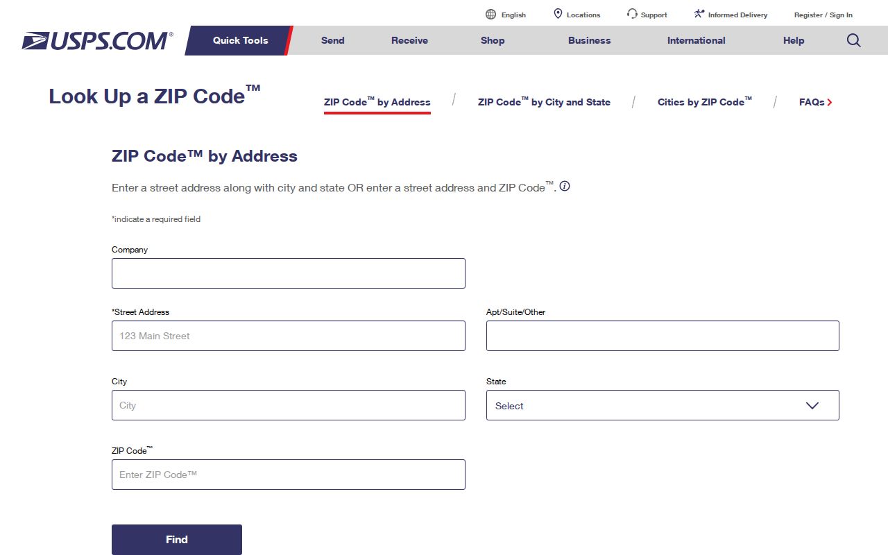
The postal lookup is a useful first confirmation, but it does not replace the Auditor’s situs or Property Parcel Number when the next task is property-record research.
| USPS address-validation item | Supported use | What not to infer |
|---|---|---|
| By-address lookup | Enter the exact civic address to check its postal ZIP result. | Do not use it as a city-limit decision. |
| Returned postal result | Retain the mailing ZIP shown for that address and date of check. | It does not supply a parcel identifier or owner. |
| Address comparison | Compare the postal result with the Auditor’s situs and parcel record. | A postal label alone does not identify the municipal custodian. |
| ZIP+4 display, if returned | Use it as a delivery-detail confirmation for the entered address. | It is not a substitute for a legal description. |
The capture supports an address-to-ZIP check, but it does not document a local bulk ZIP interface. For repeated research, validate each actual address separately and note when the check was made. That preserves the narrow fact the tool can establish and prevents a delivery result from being reused as a broad directory claim.
Avon ZIP Codes Lack Portal Filters
The research found no local portal with a verified ZIP filter that returns all records for 44011. The Lorain County Auditor Real Estate Search is organized by Parcel, Owner, or Address. The Lorain County Recorder Property Search uses name, parcel number, or date after account access. The Lorain voter lookup is an individual first-and-last-name check. None is verified as a one-click, all-record postal search.
That limit is useful information. Do not turn a mailing code into a promise of a complete people list. Start with the exact address or a specific name, retain the source identifier that the office returns, and use a targeted request when a particular existing local record is needed.
Postal geography is still a helpful organizing clue. It can tell a researcher which address to validate first, especially near Avon Lake, Westlake, Sheffield, or North Ridgeville. It cannot replace the parcel-by-parcel work required by the Auditor, nor can it convert the Recorder’s name-and-parcel index into an address-wide search. Keep the postal and record-system steps separate.
Route Avon ZIP Codes to Records
When the goal is to validate a particular Avon address, postal geography comes first only as a check. The record workflow then moves to the situs, parcel, and legal-description systems that the county actually uses. This sequence avoids treating an address label as proof of an ownership connection or municipal boundary.
- Run the complete address through the USPS lookup and save the displayed postal result.
- Search the same address in the Lorain County Auditor interface and retain the Location and Property Number returned.
- Use the City of Avon map collection to compare the civic setting, without assuming a postal label proves city jurisdiction.
- When an instrument is needed, take the parcel and legal clues to the Recorder Property Search; the parcel number must be entered without dashes.
Once the ZIP has narrowed the area to a named road, the Avon street directory explains the separate parcel-to-instrument workflow for that address. It is the better route for a road-level question because ZIP geography does not identify a continuous street record.
Avon ZIP Boundaries and City Limits
City limits determine municipal services, zoning, Mayor’s Court and city-record jurisdiction. USPS ZIP codes are delivery geographies, while Census ZCTAs are Census approximations. Those three maps need not match. A postal “Avon” label therefore does not, by itself, prove that an address lies within the City of Avon, and a border-area record may need a different municipal custodian even when its mailing geography seems familiar.
Avon borders Avon Lake to the north, Westlake to the east, Sheffield to the west, and North Ridgeville to the south. For a boundary-sensitive question, verify the Auditor’s situs and Property Number first, then compare a city map and the USPS result. That is more reliable than trying to derive a municipal line from a postal code.
Avon ZIP Terms for Records
These terms help separate delivery detail from the identifiers that guide Avon property research. The definitions describe postal concepts only. The research did not identify a PO-box-only or unique ZIP for City of Avon, so neither should be added to the local coverage table.
- ZIP code
- A USPS delivery geography used to route mail. It is not a parcel boundary or city-limit determination.
- ZIP+4
- An added postal delivery detail that may appear for a specific address; it does not replace a parcel number or legal description.
- PO-box ZIP
- A postal designation that can be assigned for post-office boxes rather than street delivery. This is a definition, not a documented Avon designation.
- Unique ZIP
- A dedicated postal code for a single organization. This is a definition, not a documented Avon designation.
- Carrier route
- A mail-delivery grouping used by USPS operations. It is not a city district, ownership record, or public directory.
Avon ZIP Corridors Are Map Clues
Detroit Road and French Creek are part of Avon’s historic spine, while documented corridors also include Avon-Belden, Center, Chester, Stoney Ridge, Nagel, and Schwartz Roads. They are useful terms for city maps, newspapers, tax maps, and historical research. They do not establish a formal numeric street grid, a block-number formula, or a ZIP boundary. No authoritative Avon citywide renumbering, E911-addressing authority, or ZIP-realignment year was located in the research.
Use a corridor name as a map or record-search clue, then return to the exact address and Property Number. This preserves the useful local geography without creating a rule that the city has not documented.
Avon ZIP Geography Is Not Population
Avon had 24,847 residents in the 2020 Census and an estimated 25,611 on July 1, 2025, across 20.79 square miles. Those citywide figures help explain why older farm-era parcels, later subdivisions, and newer development can appear in the same local research path. They are not ZIP-level counts, and they do not justify estimating who is attached to a particular postal area.
For historical work, modern postal labels can be even less useful. Directory titles must be read for the locality and year they cover: the research found that a 1955 Elyria directory includes Avon, while a 1959 title explicitly does not. Search the historical locality named by the collection rather than assigning a modern postal label to an earlier record.
That same caution applies to map labels. A Detroit Road or French Creek reference can orient a search within Avon, but it cannot establish the mailing ZIP for every address on the corridor. Use the full address in USPS, then the returned Property Number in county records. The result is slower than a broad postal filter, but it follows the identifiers the local custodians actually maintain.